
DRIP is hiring a new Program Director!
Disaster Resilience Information and Partnership (DRIP) Program
Technical Assistance for Under-Resourced Texas Communities
About
Originally launched in 2022 as a Texas Legislature-funded pilot, the Disaster Resilience Information and Partnership (DRIP) program was developed in partnership with Texas communities to support locally driven flood resilience. The program focused on improving access to flood-risk data, strengthening community understanding of risk, and supporting evidence-based mitigation and planning decisions.
Following new legislative funding for IDRT in 2025, the DRIP program is being expanded and institutionalized—building on the collaborative, community-centered model shaped during the pilot phase.

Our Mission
DRIP’s mission is to empower under-resourced Texas communities with digital tools and training to make informed disaster mitigation decisions, secure funding, and reduce future losses.
DRIP Program Relaunching in 2026
DRIP will relaunch in 2026 as a permanent program within the Texas A&M Institute for a Disaster Resilient Texas (IDRT).
The relaunched DRIP program will continue to support under-resourced Texas communities facing chronic or acute flooding through:
- Improved access to and understanding of flood-risk data
- Training and technical assistance
- Community engagement and partnership opportunities
IDRT is currently preparing for the relaunch, including hiring a full-time DRIP Program Director and establishing a Rural Leaders Advisory Council to ensure community priorities and perspectives guide the program’s future direction.
Additional details about program offerings, partner opportunities, and timelines will be shared in the coming months. We encourage interested communities and partners to check back soon or contact drip@tamu.edu for updates.
Want to know more? Email us at drip@tamu.edu to join our mailing list.
Our Work
Beginning in 2022, DRIP collaborated with ten partner communities experiencing chronic and acute flooding events across six diverse regions in the state to develop products, such as customized flood risk maps, for all the partner communities.
Two DRIP communities, Fort Hancock and Wise County, were selected for additional, customized projects to serve as proof-of-concepts that could be expanded to other locations in the future – the Wise County Flood Depth Surface Elevation Visualization Project and the Hudspeth County/Fort Hancock Community Flood Knowledge Collection Project.
Through our past work, we have:
- Connected with a diverse group of under-resourced communities through interviews and focus groups to identify flood mitigation data needs and develop the overall DRIP program from the ground up.
- Traveled across the state, and held more than forty meetings with county and city officials and staff about their flood data challenges and needs.
- Identified a clear initial need in all communities to assemble and visualize the best available flood risk data for each community.
- Scoped two in-depth data analytics and technical assistance projects to complete during the initial funding period.
Testimonials

“DRIP's program is not just life changing.... This will change generations in this community.”
Judge Joanna MacKenzie
Hudspeth County
"Any community that wants to take a serious look at what their hazards are, and wants to get closer to being able to obtain information that's actionable for what they can do about those hazards, should work with DRIP.“
Cody Powell
Wise County Emergency Management Coordinator


“This project has made us feel like we belong. Other people came into our community once and promised to help us, but we never saw them again. The DRIP team has come back repeatedly, understood what we want to do, and allowed our community to build capacity.”
Sergio Quijas
County Commissioner, Precinct 2, Hudspeth County
"DRIP has helped us find solutions. Whether that’s a set of data or a runoff calculation or connecting us with a resource we didn’t know existed.”
Nathan Mara
City Manager, City of Decatur


“DRIP’s program is not just life changing…. This will change generations in this community.”
Judge Joanna MacKenzie
Hudspeth County Judge

“Any community that wants to take a serious look at what their hazards are and wants to get closer to being able to obtain information that’s actionable for what they can do about those hazards, should work with DRIP.“
Cody Powell
Wise County Emergency Management Coordinator
“This project has made us feel like we belong. Other people came into our community once and promise to help us, but we never saw them again. The DRIP team has come back repeatedly, understood what we want to do, and allowed our community to build capacity.”
Sergio Quijas
Precinct 2 County Commissioner, Hudspeth County
DRIP has helped us find solutions. Whether that’s a set of data or a runoff calculation or connecting us with a resource we didn’t know existed.”
Nathan Mara
City Manager, City of Decatur
DRIP's Key Partners:
Latest News
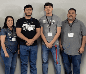
Data From the Heart of the Desert: A Community Making a Difference
Fort Hancock, also portrayed in our previous blog posts, is a community of hard-working individuals. Even though this is a desert, it is also a
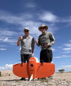
Using Drones to Address Data Deserts
By Nicholas Diaz, PhD student, and Dr. Andrew Juan, Associate Research Scientist Arriving in Fort Hancock, Texas for the first time, it was clear to
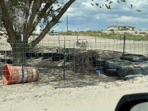
A True Data Desert: Fort Hancock, Texas
Imagine being new in a community. Regardless of whether you rent or own your home, you need to get your utilities—e.g., water, power, trash—connected and